MONTGOMERY COUNTY NEW YORK REGIONAL NWS SEVERE WEATHER ALERTS

Left click to see a larger image.

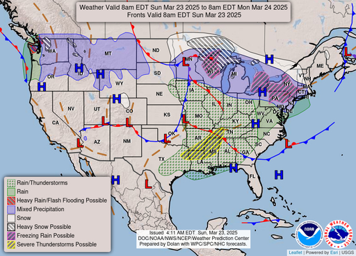
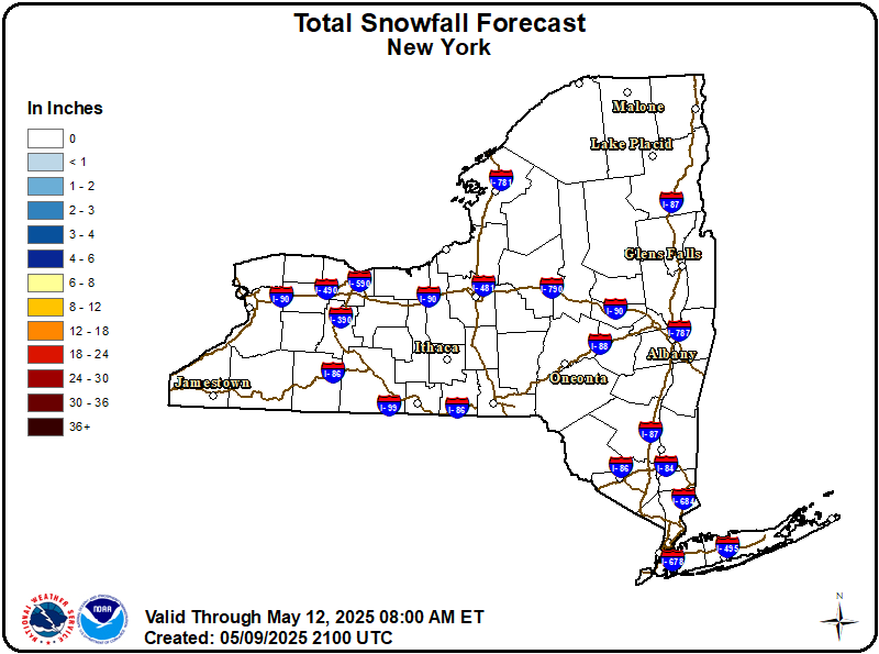
National Forecast Chart Total Snowfall Forecast - New York
         Radar/Satellite image credits can be found here.
spacer
METRIC | IMPERIAL
Updated: 10-Nov-2026 @ 1:10am   (0 sec ago)
Temperature Current Conditions National Weather Service Forecast
Currently Outside

42.7°F

Trend:Colder 0.2°F than last hour. /hr
Wind Chill   36°F
24-hr temp diff -3.9°FColder 3.9°F than yesterday at this time.
---
High Today
42.9°F
12:00 AM
Low Today
42.7°F
12:40 AM
Yesterday H
48.5°F
Yesterday L
42.9°F
Last Year H
42.1°F
Last Year L
27.9°F
ITW Records Since 12/2012
Station High
76.0°F
2020
Station Low
18.3°F
2017
Albany Intl. Airport Records
Record High
72°F
1931
Record Low
16°F
1965
Albany Intl. Airport Normals
Normal High
52°F
Normal Low
33°F
Snow Forecast 10:00PM
Rest of Today Tuesday Wednesday
0 % 0 % 0 %
Click here - 5 Day Snow Forecast
Dry Dry

Wind from W Wind:  W
12.3

Gusting to:
9.1 mph
Current Rain Rain:
0.00 in

Current Allergy Forecast Hessville, New York

Predominant Pollen:
Ragweed
Tue Wed Thu Fri
1.2
1.5
3
1.8


Low Low-Med Medium Med–High High
Click here for full Forecast
Tonight

Tonight: Slight Chance Rain Showers then Mostly Cloudy
Slight Chance Rain Showers then Mostly Cloudy
Tuesday

Tuesday: Partly Sunny
Partly Sunny
Tuesday
Night
Tuesday Night: Scattered Rain Showers then Mostly Cloudy
Scattered Rain Showers then Mostly Cloudy
Lo 37 °F Hi 57 °F Lo 37 °F
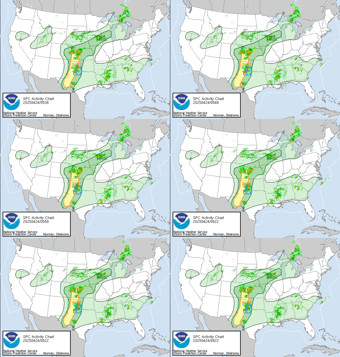
Storm Prediction Center
SPC Activity Map
ITW Station Fun Facts
Moon Phase Misconception...
"The most common incorrect reason given for the cause of the Moon's phases is that we are seeing the shadow of the Earth on the Moon! But this cannot be correct: when the Moon passes through the shadow of the Earth, we get a lunar eclipse. Anyone who has seen a lunar eclipse, though, might remember that the Moon actually passes through the Earth's shadow only rarely, so that can't be why the Moon has phases. The real reason for the Moon's phases depends on two things: the Moon is round, and the angle it makes with the Earth and Sun changes over its orbit."
- As Quoted From Bad Astronomy
Dew Point Liquid Precipitation Wind Speed Sun/Moon
Current: Decreased 0.2°F since last hour. 32.1°F
Last Hour: Decreased 0.2°F since last hour. -0.2°F
High 12:00 AM: 32.3°F
Low 12:40 AM: 32.1°F
Record High: 72.1°F on
Sep-3-2026
Record Low: 20.5°F on
Oct-25-2026
Wetbulb: 38.6°F
Leaf Wet:7 0
Rain Today
rain graph

Today: 0.00 in
Storm Rain: 0.76 in
Yesterday: 0.07 in
Last 7 Days: 0.78 in
Nov Rain: 0.78 in
Nov to Date
  Avg:10
0.67 in
Nov to Date
  Diff from Avg:10
Over 0.11 in for the month 0.11 in
Nov Avg: 0.00 in
Diff from Avg: Over 0.78 in for the month 0.78 in
Season:1 3.85 in
YTD
  Avg:11
3.71 in
YTD
  Diff from Avg:11
Over 0.14 in for the year 0.14 in
Last Rain
Time/Date:
Nov-9-2026
at 8:59 AM
103 rain days in 2026
4 days in November
0 days since last rain
Current: W  12.3 mph
1Hr Average: 12.7 mph
Wind Run: 14.97 miles
Wind Gust
Current: 9.1 mph
Today: 9.2 mph 7:50 AM
Month: 24.0 mph Nov-9
Year: 27.6 mph Sep-10
Record Gust: 27.6 mph
Sep-10-2026
9 hrs 58 mins 53 secs
of daylight today
NOON
Sunlight Pie
MIDNIGHT
Sunlight Legend
2 minutes and 20 seconds
shorter than yesterday

Waxing Crescent
Waxing Crescent, 0 days, 23 hours, 12 minutes in cycle
1%
Illuminated
Humidity Barometer
Current: No Change 66%
Last Hour: No Change 0%
High 12:00 AM: 66%
Low 12:00 AM: 66%
Record High: 99%
Sep-2-2026
Record Low: 46%
Sep-7-2026
Current: Falling 0.012  inHg/hr 29.928 inHg
Last Hour: Steady
High 12:00 AM: 29.941
Low 1:07 AM: 29.928
Record High: 30.590 inHg
Oct-25-2026
Record Low: 29.560 inHg
Oct-16-2026
Heating Degree Days Soil Conditions8 Wind Chill Air Quality
Today: 0.9
Nov: 105.2
2026 to Date: 4609.9
Cooling Degree Days
2026 to Date: 462.9
0.4 in: 151.0 cb | 48°F
1.2 in: 200.0 cb | 50°F
2.4 in: 40.0 cb | 53°F
3.6 in: 43.0 cb | 55°F

Growing conditions
at the depth of:  0.4 in:


Soil moisture range is from
0-Wet to 200-Dry/Frozen
Current: 36.1°F
Low 12:40 AM: 36.1°F
Yesterday: 35.6°F
Record: 26.2°F
Oct-18-2026
Hessville, NY
NowCast AQI6

4


Good
Density:
1.26 kg/m3
Current UV Index Current Solar Energy9
0.0
Sunburn in
720 Minutes
Highest:
12:00 AM
0.0
0 W/m2
0%
Solar % ⇒ SI
High Today:
12:00 AM
0  W/m2
Record:
970 W/m2
Almanac Irrig. Index5/WebCam Station All Time Records Cloud Level
Currently: Night
YTD Avg Temp: 52.3°F
Sunrise: 12:40 am
Sunset: 12:47 pm
Moonrise: 1:23 am
Moonset: 1:47 pm
Full Moon: Nov-24-2026
New Moon: 7:53 PM EST
Dec-08-2026
Winter
Begins:
3:50 PM EST
Dec-21-2026
Countdown to Winter
Updated at Midnight
Current ET: 0.08 in
7-Days Rain: 0.78 in
7-Days ET: 1.00 in
7-Day:  0.22 in water in deficit of what evaporated in last 7 days. 0.22 in
November:  0.34 in water in excess of what evaporated this month. 0.34 in
Irrigate in: 0 days
WeatherCam Front Yard
WeatherCam Image
HIGHS: LOWS:
80.4°F
Sep-3-2026
30.4°F
Oct-25-2026
6am-6pm Avg Temp Record
  79.2°F
Sep-03-2026
  41.7°F
Oct-17-2026
6pm-6am Avg Temp Record
  70.9°F
Sep-10-2026
  34.9°F
Oct-18-2026
Indoor Temp: 69°F 
ICN:2 | S3C2:1 | Ajax 3.xx
ISS:Station 4 Low | CON:4.7 | RCP:95%
METRIC | IMPERIAL
Updated: 10-Nov-2026 @ 1:10am  
1 Rain season: Jan 1st to Dec 31st.   2 Snow season July 1st to June 30th.   3 Snow manually measured usually around 7AM and 7PM.   5 Estimated amount of water needed to replace the water used by plants and evaporation from the past week. (Negative numbers mean amount of water needed, positive numbers mean excess water is present).   6 NowCast Air Quality Index µm2.5 is provided by Indian Trail Weather, Hessville, NY, using a Davis Airlink 7210.   7 Leaf Wetness is surface moisture on foliage. 0 being totally dry and 15 being totally saturated.   8 Soil moisture and temperatures are from sensors burried in the ground at the levels specified.   9 Solar Index represents either an absolute scale of solar energy (W/m²) using the station’s recorded maximum or a percentage of computed theoretical solar maximum using the station’s location and time of day. These indices differ most when the sun is low on the horizon. The current scale is shown, and will toggle if it or the icon is clicked.   10 Historical average only to day 10 of just the month of November for this station since 2012.   11 Historical average rain this season to day 10 of November for this station since 2012.
 NWS Weather Forecast  -   Outlook Tonight & Tuesday
Tonight

Tonight: Slight Chance Rain Showers then Mostly Cloudy
Slight Chance Rain Showers then Mostly Cloudy

Lo 37°F
NWS forecast: A slight chance of rain showers between 10pm and 11pm. Mostly cloudy, with a low around 37. West wind 6 to 10 mph, with gusts as high as 22 mph. Chance of precipitation is 20%.
WXSIM forecast: Cloudy. A slight chance of rain. Low 40°. Wind west around 9 mph, gusting to 18 mph. Chance of precipitation 20 percent. Precipitation mostly less than a tenth of an inch.
VP2 automated forecast: Increasing clouds with little temp change.
Tuesday

Tuesday: Partly Sunny
Partly Sunny

Hi 57°F
NWS forecast: Partly sunny, with a high near 57. West wind 5 to 13 mph, with gusts as high as 23 mph.
WXSIM forecast: Mostly cloudy to cloudy in the morning, becoming partly cloudy in the afternoon. Patchy light fog in the morning. A chance of rain. High 51°. Wind west around 7 mph, gusting to 17 mph, in the morning, becoming 12 mph, gusting to 20 mph, in the afternoon. Chance of precipitation 30 percent. Precipitation mostly less than a tenth of an inch.
 NWS Short Term Weather Forecast
Tuesday
Night
Tuesday Night: Scattered Rain Showers then Mostly Cloudy
Scattered Rain Showers then Mostly Cloudy
Veterans
Day
Veterans Day: Partly Sunny
Partly Sunny
Wednesday
Night
Wednesday Night: Chance Light Rain
Chance Light Rain
Thursday

Thursday: Light Rain Likely
Light Rain Likely
Thursday
Night
Thursday Night: Light Rain Likely then Chance Rain And Snow
Light Rain Likely then Chance Rain And Snow
Friday

Friday: Chance Rain And Snow
Chance Rain And Snow
Friday
Night
Friday Night: Chance Rain And Snow
Chance Rain And Snow
Lo 37°F Hi 53°F Lo 34°F Hi 49°F Lo 31°F Hi 43°F Lo 27°F
ajax-dashboard6.php - Version 6.95h - 20-Feb-2023 - Script by: Scott of BurnsvilleWeatherLIVE.com
Now supported by Saratoga-weather.org Download

TODAY IN WEATHER HISTORY


usaflag Smokey usaflag


Go to DreamHost